Mountains present a different profile to the observer from each separate location. It is useful therefore if the tourist provider at popular Viewpoints gives such information in graphic form on an accessible plinth.
This is precisely what Louth County Council has provided – in relation to the Low Mournes across the Lough – at Carlingford Forest Park Viewpoint. I am particularly enamoured of this forest park, its picnic areas and planned walks, of its incredible views of our local fjord with all its charms, the bramble path that leads through fairy ways down into the ancient walled town of Carlingford. Every inch holds invaluable memories from each stage of my life: the carefree days of youth; ‘courting’ days and girls long gone from my life but remembered in the recesses of memory; day trips with my wife and our five children in every stage of their development; friends who have now passed on, like Walter Harrison, my dear departed father-in-law, the only man I ever knew who was even more exuberant than me in his praise of the great natural beauty of our district.
If I go on any more like this I’ll have to take a break and go and visit! And I don’t need to, for tomorrow is Sunday and we will go down as usual to Carlingford to hear our jazz musician friends play all afternoon a capella in O’Neill’s terrace lounge! Tony Coleman – just back from his annual six months sojourn in Australia [tough life but somebody has to live it, I suppose!] – Jimmy Burns (the main man, in my eyes), Christie Hughes on trumpet and his brother on drums constitute the Four Pennies. The Session is free and on sunny Sunday afternoons continues past six o’clock. Highly recommended but please leave two empty spaces for us regulars!
I keep getting distracted. Sorry. I was about to scan the distant mountain profile from Carlingford Forest.
Over to your left are the foothills of the Low Mournes [as distinct from the High Mournes towards Newcastle – Donard and the like]. The first there is the evocatively named Thunder Hill. Then there’s Lecan More, Slieve Rossley and Crotlieve. The Crotlieve Ward of Newry and Mourne District Council stretches back from here to the north side of Newry Town where I live, but includes Hilltown [appropriately named The Gateway to the Mournes].
The first of the higher peaks over there is Slieve Martin whose lower slopes are covered with the ancient oak forest I have previously lauded, as well as extensive spruce and fir forests. It also has the fabulous Kilbroney Park and amenity area. When not in Carlingford on sunny summer afternoons, we spend many happy hours there, climbing up to the Big Stone. More memories!
Behind it the higher Slieve Meen and behind and beyond it is Spelga. In a nook here is Spelga Dam, containing the wide waters that feed the domestic requirements of large areas including Belfast. It has nearby a very unusual feature that I just have to tell you about.
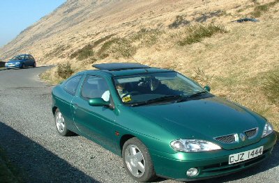
You drive to this location out of Hilltown, taking the first road right after the village. As you negotiate the hair-pin bends rising at a 1:3 elevation you will quickly note the great dam wall before you. One hundred metres before the dam there is a tiny slip road that descends to a small stone ‘control’ building just another one hundred metres below. Drive down and park. Then release your handbrake and wait.
Amazingly your car will begin to roll of itself UP the hill you have just descended. There are other locations throughout the Mournes where this strange phenomenon can also be experienced. There is no trick involved. And you definitely roll UPHILL. We call such places ‘Gravity Hills’ because they defy gravity. Eat your heart out, Isaac Newton!
The distant profile is completed with the charmingly named Knockshee and Knockchree. The latter means Hill of the Cattle, and the former Fairy Hill. Most Mourne peaks and features have such descriptive names. I’ll conclude by listing a few.
Carniagh the rocky place
Leitrim grey ridge
Aughrim horse ridge
Knocknagore hill of the goats
Attical place of hazels
Corragh rugged mountain
Slievemuck pig mountain
The Brandy Pad smugglers’ ancient route!
Deer Meadow self-explanatory!
Moolieve bare mountain
Slieve Donard S Donard’s mountain
Ben Crom stooping mountain
Mell Beg little bare mountain
Slieve Binnian mountain of sharp peaks
Wee Binnian little mountain of bare peaks
An Owen Owen’s mountain
Rocky Mountain self-explanatory
Derryogue grove of young oaks
Moyadd long plain
Cnoc na Roe red hill
Lamagan creeping mountain
Moneydarragh oak grove
Dunaval fort of the hedges
Pookah fairy [river]
Formal round hill
Will the green car free-wheel up to the position of the blue car? You betcha it will!
